
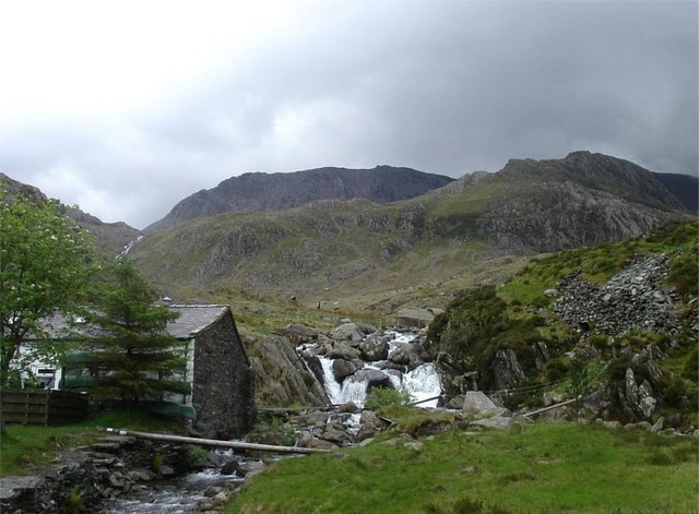
Waterfall on River Idwal, Ogwen

Routes / Trips

Driving the North Wales Way

2-day trip

Days2
Distance162mi
Driving6hours
Our routes4
Stops6
Nights2

The North Wales Way follows the old trading route along the northern coast to Anglesey, and at about 75 miles it is the shortest of the three Wales Way routes. Most of that is the A55, so we keep the coast and the castles and add the roads a driver would come for: the Clwydian Range, the Conwy valley, the Ogwen valley and the Anglesey coast.

Two days and about 160 miles, with every road, stop and night chosen and mapped for you. Open it on your phone and it guides you all the way, even where there's no signal.

The Wales Way is Visit Wales' family of three national touring routes. This is our own version for keen drivers rather than an official itinerary. For the full route and a slower pace, see the North Wales Way on Visit Wales. New to Welsh roads? Read our guide to driving in Wales.

  1. Day 1Loggerheads to Betws-y-Coed67 mi
  2. Day 2Betws-y-Coed to the Menai Strait95 mi

The climb

Every day end to end · highest point 360 m
Start · 0 miFinish · 162 mi
01
Day 1

Loggerheads to Betws-y-Coed

67 mi 2 h 29 driving 2 routes

Bwlch Penbarras crosses the Clwydian Range to Ruthin, then the road drops north to the coast at Rhuddlan, whose castle guards the river Clwyd. Along the coast to Llandudno for the Great Orme, then south up the Conwy valley to Betws-y-Coed.

Tonight: the Royal Oak Hotel, Betws-y-Coed.

The road, in order

  1. Joining roads, mapped for you
    0.8 mi
  2. 01
    Bwlch Penbarras and the Clwydian Range Scenic road Tafarn-y-Gelyn to Ruthin ⇄ the other way round
    5.5 mi
  3. Joining roads, mapped for you
    33.6 mi
  4. 02
    The Great Orme and the Conwy valley Scenic road Llandudno to Betws-y-Coed
    26.2 mi
  5. Joining roads, mapped for you
    1.0 mi

Stops along the way

  1. 09:00
    Tŷ’r Felin, Loggerheads Motoring cafés

    Coffee at the foot of the Clwydian Range.

  2. 13:00
    Ann’s Kitchen Motoring cafés

    Lunch on the Conwy side of the coast.

  3. Conwy Falls Café Motoring cafés

    An afternoon break by the falls.

02
Day 2

Betws-y-Coed to the Menai Strait

95 mi 3 h 09 driving 2 routes

The A5 climbs through the Ogwen valley and down to Bangor and Penrhyn Castle. Cross to Anglesey and take the A55 to its end at Holyhead, where the North Wales Way finishes. Then turn back along the north coast from Cemaes to Menai Bridge, with a short run out to Beaumaris Castle.

Tonight: Château Rhianfa, on the Menai Strait.

The road, in order

  1. 01
    The A5 through the Ogwen valley Driving road Betws-y-Coed to Bangor
    23.0 mi
  2. Joining roads, mapped for you
    42.0 mi
  3. 02
    The Anglesey coast Scenic road Cemaes to Menai Bridge ⇄ the other way round
    28.8 mi
  4. Joining roads, mapped for you
    1.4 mi

Stops along the way

  1. Penrhyn Castle Stops and sights

    The slate baron's castle above Bangor.

  2. Beaumaris Castle Stops and sights

    Edward I's last great castle, on the way to dinner.

  3. 19:30
    Sosban & The Old Butchers Restaurants

    Dinner by the Menai Bridge.

The live trip

Every day on one map, with turn by turn and offline maps for the hills