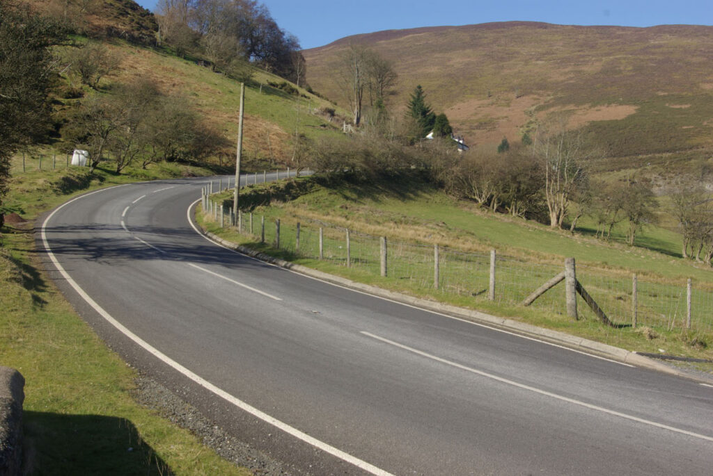
The summit of the Horseshoe Pass sits at about 417 m on the A542 between Llangollen and Ruthin. Its Welsh name, Bwlch yr Oernant, means the pass of the cold stream. The English name comes from the way the road swings right round the head of a steep valley, between Llantysilio Mountain to the west and Cyrn-y-Brain to the east. The route dates from a turnpike road built in 1811.
For decades the Ponderosa Café at the top was the meeting point for bikers and car clubs. It shut for maintenance in November 2024, the owners confirmed in March 2025 that it would not reopen, and it was later put up for sale. The lay-bys are still here and still busy on fine weekends, but there is no food or coffee at the top. What you stop for now is the view: back down the horseshoe and across the hills towards the Eglwyseg valley. Sheep wander onto the road, and the open top is often shut by snow or landslides in winter.
The summit is the high point of our Horseshoe Pass drive from Llangollen to Ruthin. The horseshoe itself is best seen on the climb from the Llangollen side, so pull in at the top and look back. From Ruthin, at the far end, Bwlch Penbarras climbs straight into the Clwydian Range, which makes a natural second half to the day.
Good to know
- No café at the summit since 2025. Eat in Llangollen or Ruthin, or at the cafés on the way.
- Take care pulling out of the lay-bys, especially at weekends when bikes gather.
- In ice or snow, check with Denbighshire County Council before you set out.
Photo: Horseshoe Pass by Stephen McKay, CC BY-SA 2.0
Contact
About
The 417 m top of the A542 Horseshoe Pass between Llangollen and Ruthin, with roadside lay-bys and no café since the Ponderosa closed in 2025.
Location
The roads from here
- The Horseshoe Pass, Bwlch yr Oernant (A542): Llangollen to RuthinUnder a mile away · 15.2 mile drive · Driving road
- Bwlch Penbarras and the Clwydian Range: Ruthin to Tafarn-y-GelynAbout 8 miles away · 5.5 mile drive · Scenic road
- The Evo Triangle (A5, B4501, A543): Pentrefoelas, Cerrigydrudion and the Denbigh MoorsAbout 14 miles away · 23.0 mile drive · Driving road