
Guide
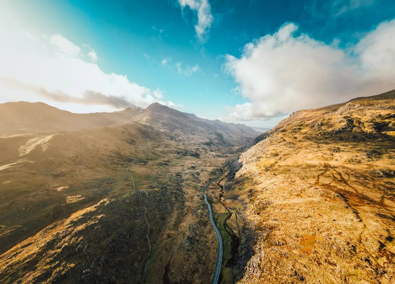
If you have one day in Eryri (Snowdonia), drive the lap of Yr Wyddfa (Snowdon): about 35 miles over the Llanberis Pass and back through Nant Gwynant, which Visit Wales times at 1.5 to 2 hours without stops. With a second day, take the A5 through the Ogwen valley, then the Crimea Pass and the Migneint. Most of it runs on A-roads, and we would base ourselves in Betws-y-Coed, where most of these roads begin.
| Road | Class | Length | Time | Summit |
|---|---|---|---|---|
| The Llanberis Pass (A4086) | Driving road | 23.6 mi | 45 min | 359 m |
| The A5 through the Ogwen valley | Driving road | 23.0 mi | 45 min | 315 m |
| Nant Gwynant and the Aberglaslyn Pass | Driving road | 15.6 mi | 30 min | 294 m |
| The Crimea Pass | Driving road | 13.2 mi | 25 min | 386 m |
| The Migneint | Driving road | 19.6 mi | 40 min | 461 m |
| The Nantlle valley | Scenic road | 10.8 mi | 20 min | 247 m |
Why Eryri, not Snowdonia
In November 2022 the National Park Authority voted to use Eryri and Yr Wyddfa in place of Snowdonia and Snowdon, in English as well as Welsh, without requiring anyone else to follow. Most road signs and searches still use both, so we give the English in brackets once and move on. The Authority’s own guide says Yr Wyddfa sounds like uhr with-va.
A lap of Yr Wyddfa
This is the one to do first. We would run it anticlockwise from Betws-y-Coed, so the Llanberis Pass comes early, before the coaches:
- The A5 to Capel Curig, then the A4086 to Pen-y-Pass and down the Llanberis Pass.
- Towards Caernarfon, then the A4085 south by Rhyd Ddu to Beddgelert, the closing miles of our Nantlle route.
- The A498 back up Nant Gwynant to Pen-y-Gwryd and home by Capel Curig.
With an extra half-hour, leave the A4085 at Rhyd Ddu and go out and back on the B4418 through Drws-y-Coed, a narrow road with stone walls tight to the tarmac. It is the framed view of Yr Wyddfa across Llyn Nantlle Uchaf that makes it worth doing.
The Llanberis Pass
Our full route is 23.6 miles from Betws-y-Coed to Caernarfon, on a 359 m summit at Pen-y-Pass. The pass itself is short, a rock-walled drop between the Glyderau and the Snowdon massif, then the road levels out along Llyn Padarn. Limits run from 30 to 60 mph. There is a clearway through the pass, so verge parking brings a ticket. Early morning or a summer evening is when you can enjoy it, and walkers and cyclists use it all day, so give them room.
Ogwen and the A5
Telford’s road to Holyhead has its finest miles here, and our route covers 23 miles from Betws-y-Coed to Bangor, over a 315 m summit. It climbs past Swallow Falls to Capel Curig, runs west beneath the Glyderau to Llyn Ogwen, where Tryfan rises straight from the roadside, then tips over into the Nant Ffrancon pass. Limits vary from 20 to 60 mph, so watch for the changes. We class it as a driving road, well surfaced, which makes it the better choice in a low car. Penrhyn Castle is at the bottom, and the North Wales Way uses this road on its second day.
Nant Gwynant
The A498 falls away from Pen-y-Gwryd for 15.6 miles to Porthmadog. The first lay-by above Llyn Gwynant has the view everyone comes for, and it is small, so if it is full, carry on rather than stop on the road. The road then passes Llyn Dinas to Beddgelert and threads the Pass of Aberglaslyn before opening across Traeth Mawr. We would take it downhill, north to south, with the valley ahead of you. Beddgelert is busy at weekends. Y Beudy Steakhouse in Tremadog, the old Cow Shed, is the natural stop at the far end.
Crimea Pass and Migneint
These two make the second day. The Crimea Pass is the A470 from Betws-y-Coed to Blaenau Ffestiniog, 13.2 miles with a 386 m summit, past Dolwyddelan castle and over Bwlch y Gorddinan. The descent drops through cuttings straight into the slate. It can close in snow. The Migneint is the bigger road, 19.6 miles from Bala to Ffestiniog at up to 461 m, on the A4212 past Llyn Celyn and then the B4391 over open moorland. Our page notes there is no fuel between Bala and Ffestiniog, and that sheep graze unfenced across the top, so expect them on the road. We would drive it east to west and join it to the Crimea Pass at Ffestiniog. To make a longer day of it, the B4391 over Milltir Gerrig comes in to Bala from Llangynog.
South of here, Eryri has harder roads for keener or narrower cars. Bwlch y Groes reaches 546 m on our route, with gradients around 1 in 4 and single track, and is not for caravans. Tal-y-llyn and Bwlch Oerddrws run under Cadair Idris. The Harlech coast gives you the western edge with the sea alongside. For the whole picture, see our scenic drives and the best driving roads.
Where to stay
Betws-y-Coed is the base for the lap and the Crimea Pass. Further south we would go to Palé Hall for the Migneint and Bwlch y Groes.
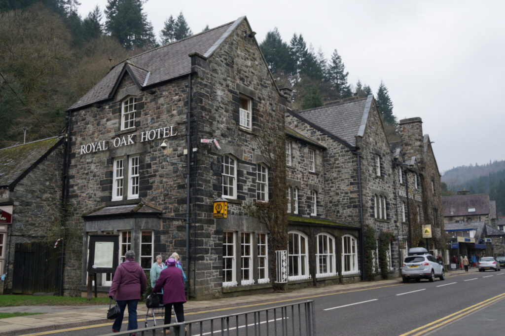
The Royal Oak Hotel, Betws-y-Coed
A Victorian coaching inn on the A5 in the centre of Betws-y-Coed, where David Cox painted the inn…
Check rates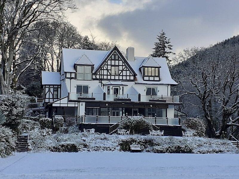
Craig-y-Dderwen Riverside Hotel
A late Victorian country house hotel in its own grounds on the River Conwy at the edge of…
Check rates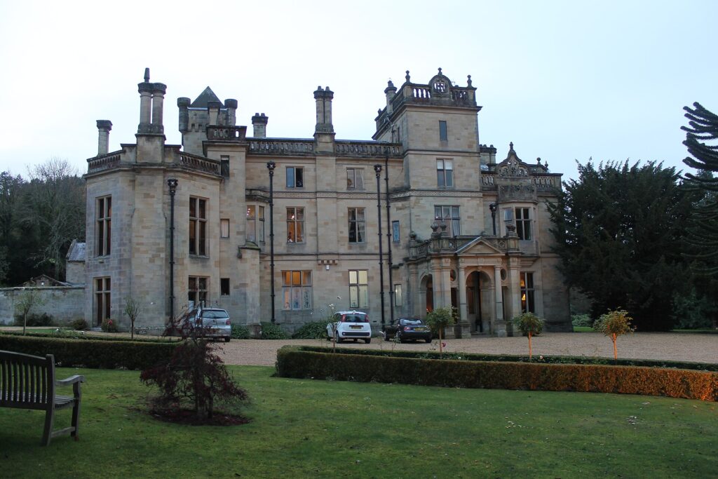
Palé Hall
A five-star Victorian country house hotel near Bala, built in 1869-71 for the railway engineer Henry Robertson, with…
Check ratesAlso worth a look: Plas Weunydd in Blaenau Ffestiniog, four stars, where the Crimea Pass ends; Plas Dinas near Caernarfon, for The Gunroom and its 3 AA Rosettes; and Penmaenuchaf near Dolgellau, four stars, for Afon. The Royal Victoria puts you in Llanberis itself at three stars. Our hotel guide covers parking.
Parking at the passes
Parking is where a good day in Eryri goes wrong. Pen y Pass runs as pay and display over the winter and goes back to pre-booking at Easter 2027, according to the National Park Authority. In the busy season it calls advance arrangements essential, and it points to the Sherpa’r Wyddfa bus from Nant Peris, Llanberis and Caernarfon as an alternative. At Llyn Ogwen, parking along the A5 fills very early with walkers, and verges are restricted. Rhyd Ddu is busy from early morning in summer. If you are driving rather than climbing, we would keep moving and stop at a café. Conwy Falls Café is the one near Betws-y-Coed.
Eryri is also an International Dark Sky Reserve, covering more than 2,000 square kilometres, so the drive back after dinner is worth taking slowly. Our driving in Wales guide covers the rules, including the 20 mph default in the villages.
Last checked 5 November 2026.
Quick answers
- What is the best drive in Snowdonia?
- The lap of Yr Wyddfa, about 35 miles over the Llanberis Pass and through Nant Gwynant. Add the A5 through the Ogwen valley if you have a second run in you.
- How long does it take to drive around Snowdon?
- Visit Wales gives 1.5 to 2 hours for the 35-mile circuit without stops. Allow half a day with a stop at Beddgelert or Llanberis.
- Do I need to book parking at Pen-y-Pass?
- Not in winter, when the National Park Authority runs it as pay and display. Pre-booking returns at Easter 2027, so check its page before you travel.
- Is the Llanberis Pass suitable for all cars?
- Yes. It is a proper A-road, the A4086. It is narrow through the rocks but needs no special care other than for walkers and cyclists.
- Why is Snowdonia now called Eryri?
- The National Park Authority voted in November 2022 to use the Welsh names in place of the English ones. Nobody else is obliged to follow, and both names remain widely understood.
- Which road in Eryri is best for a low car?
- The A5 through Ogwen or the A470 over the Crimea Pass. We would leave the Nantlle B4418 and Bwlch y Groes to something with more clearance.
Reviewed by Drive Tour Wales in November 2026. Conditions, limits and opening times change, so check before you travel.